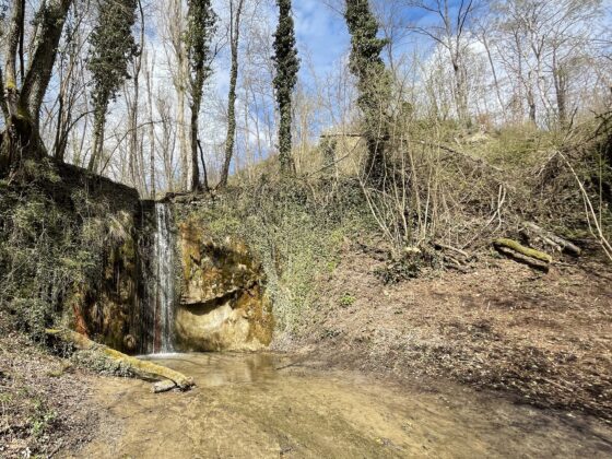
Easy hike through wide stretches of forest, with view of the falls.
Length: 7.5 km.
Height difference: + 450 m. / – 450 m.
Difficulty: E (hiking)
Route type: loop, clockwise
Starting from the center of the town of Loiano, climb to the pine forest on the hill overlooking the town. A beautiful descent along the woods leads to the striking Cascate delle Colore waterfalls, a splendid spot in the middle of the woods, near what remains of the Molino delle Colore . The ascent leads to the Bosco di Tura, a beautiful chestnut forest, with truly impressive centuries-old specimens. Leaving the woods, one finds oneself in the midst of wheat fields, a crop of great importance and tradition in this area. The final climb leads back to the village.