From La Martina Park to Tre Poggioli and Sasso della Mantesca
From La Martina Park to Tre Poggioli and Sasso della Mantesca
Gps Track
Gps Track
- Start: La Palazza, Monghidoro
- Arrival: La Palazza, Monghidoro
- Total Length: 13,0 km
- Difficulty by Foot: Medium
- Climb up: 500 m
- Climb down: 500 m
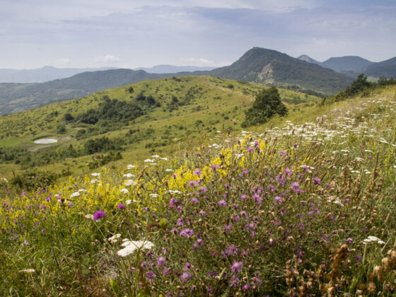
Passing through La Martina Park, this loop route allows visitors to admire its main highlights, like the forest to ophiolitic rocks and natural pools with their amphibians.
Length: 13 km.
Height difference: + 550 m. / – 550 m.
Difficulty: E (hiking)
Route type: loop, counterclockwise
Departure in front of Bar Ristorante La Palazza, where bus No. 916 also stops. You take CAI 805 trail to the entrance of the Park, then turn right following CAI 806. The trail enters the mixed forest of the park, passing near natural pools, where in season you may encounter several amphibians, including 3 species of newts. After a few kilometers, you come close to the Gurlano cliff, an ophiolite rock that emerges from the surrounding terrain. The climb continues to the ridge between Idice and Sillaro, the natural border between Emilia, Romagna and Tuscany. The highest point is marked by the summit cross of Tre Poggioli. From here it is possible to admire a second ophiolitic rock, the sasso di San Zanobi. Along the ridge we meet the monument to Captain Nicola d’Amico and finally we reach the third ophiolitic relief, the sasso della Mantesca. The descent, passing through chestnut groves and touching the beautiful village of La Martina, leads to the Bar Restaurant of Camping La Martina and, below, back to the starting point.