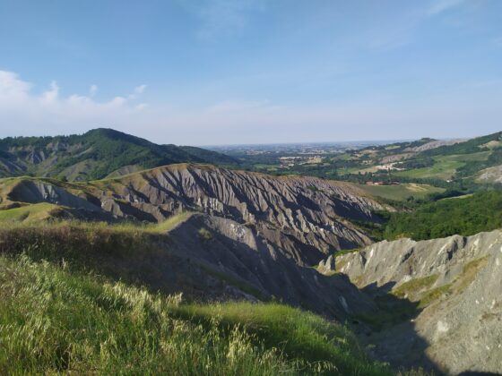
This itinerary allows you to reach the Ozzano hills starting directly from the town, crossing stupendous scenery including the beautiful Calanchi di Sant’Andrea.
Length: 13 km.
Height difference: + 350 m. / – 350 m.
Difficulty: E (hiking)
Route type: loop, clockwise
The route is mainly on dirt roads and quiet paved lanes, but with some passages on clay soil, to be avoided in case of rain.
The first section crosses two urban parks and then leaves Ozzano and heads toward the church of Sant’Andrea, which gives its name to the small village. Skirting the Villa Massei park, take the dirt road that later becomes a path; here begins the most scenically interesting section with views of the grandiose calanque formations.
The path continues to climb up to the ridge crossed by Via del Pilastrino, which you follow in the direction of Palazzina until it intersects with Via Poggio. From here you walk downhill to Ozzano, passing through Ciagnano-where you can take a short detour from the itinerary to visit the small church of Madonna delle Grazie-with panoramic views of the Badessa Pass badlands. The easy return route shows wide views of Bologna and the plains.